
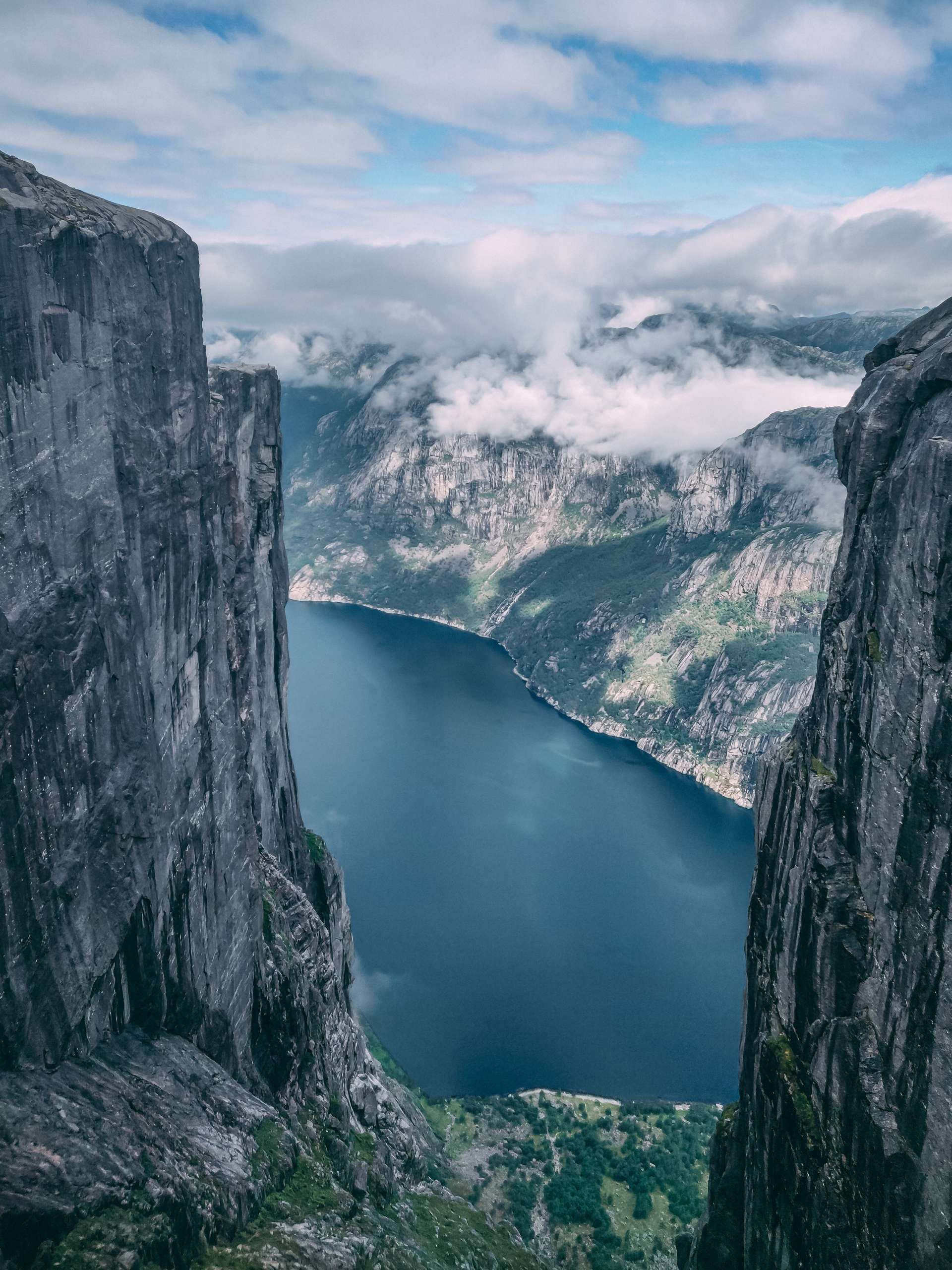
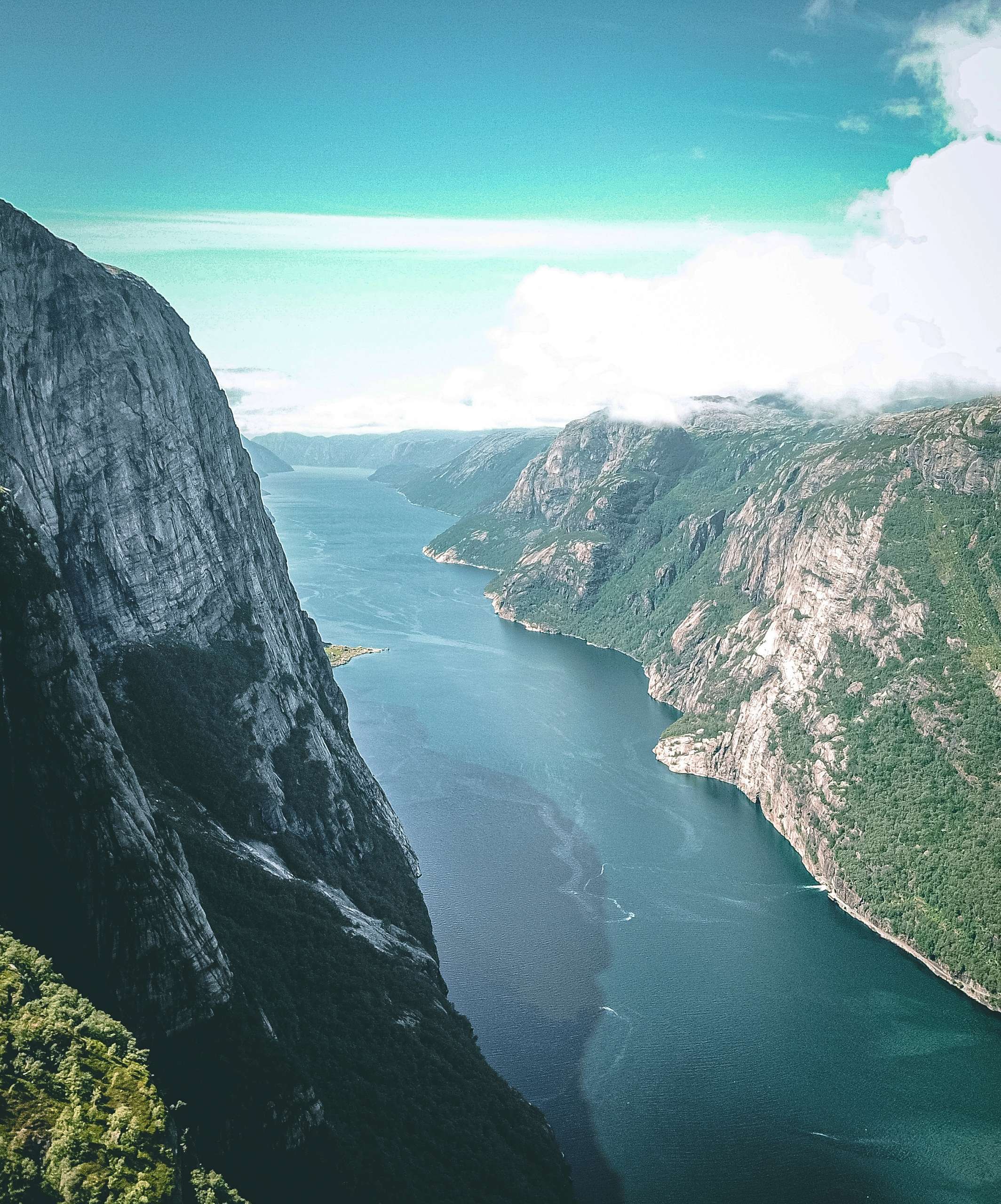
Kjerag is a mountain which is situated about 2 hours drive from Stavanger city. Kjerag mountain is popular among hikers and tourists. Some of the cliffs situated at the northern side of the mountain are massive and the cliffs plunge about 1000m directly to the fjords. Kjeragbolten, a stone wedged between two mountain walls is located on the mountain. The boulder has become very popular among tourists and base jumpers. Kjeragbolten has become social media sensation. People stand on the stone and use different technique to take pictures of the stone. The hike starting point is located about 2 hours drive from Stavanger town.
Your base should be Stavanger if you are planning to hike Kjeragbolten. I flew to Stavanger from Amsterdam and reached Stavanger at around 10 pm. During summer season the day light hours are longer in Norway. Sunset usually happens around 11.30 and sunrise happens at around 3.30 am. Stavanger airport is situated about 20 minutes Taxi ride from Stavanger Town center. The frequency of the airport bus was not that great and I didn’t want to wait for 1 hour for the bus. I took the taxi from the airport to the hotel and I paid 50 USD for 20 minutes taxi ride.
I booked my tour from https://outdoorlifenorway.com/. Outdoor life Norway organizes guided hiking tour to popular hiking destination of Norway. Transport in Norway is expensive and it is inconvenient to reach hike starting point if you don’t have your own car. The cost of the guided hike was 1390 NOK. The trip includes round trip transfer to the hike starting point and guided hike to Kjeragbolten. If you don’t have your own mode of transport or if you are not planning to take guided tour, then you can take bus from Stavanger bus station to Kjeragbolten hike starting point. The bus leaves at around 7.30 am from Stavanger and reaches the hike starting point at 10 am. The bus return from the hike starting point to Stavanger at around 4pm. So you have basically 6 hours to complete the hike. I didn’t want to rush the hike to Kjeragbolten that’s why decided to take guided tour. The round trip bus ticket cost about 640 NOK. You can book your bus tickets on Visit Norway website https://www.visitnorway.com/listings/bus-to-kjerag/142543/.
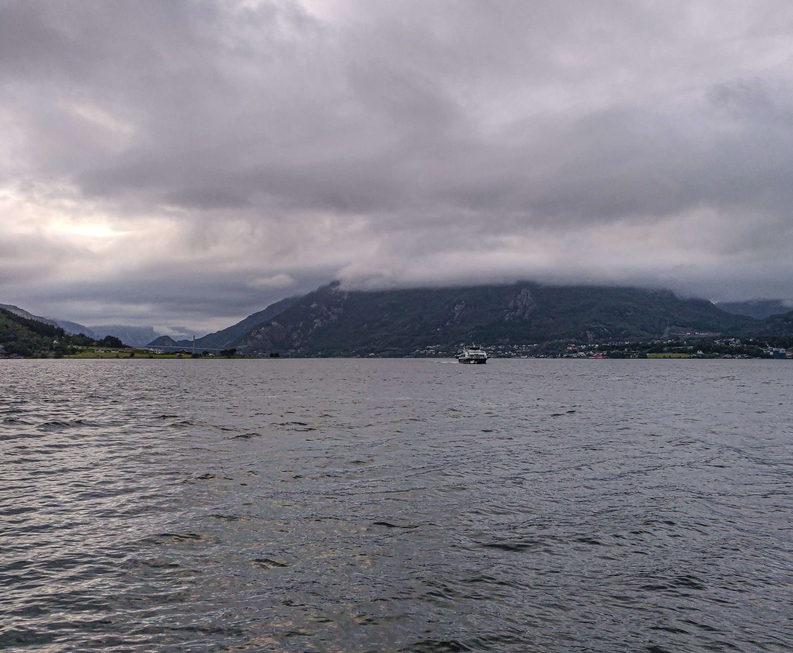
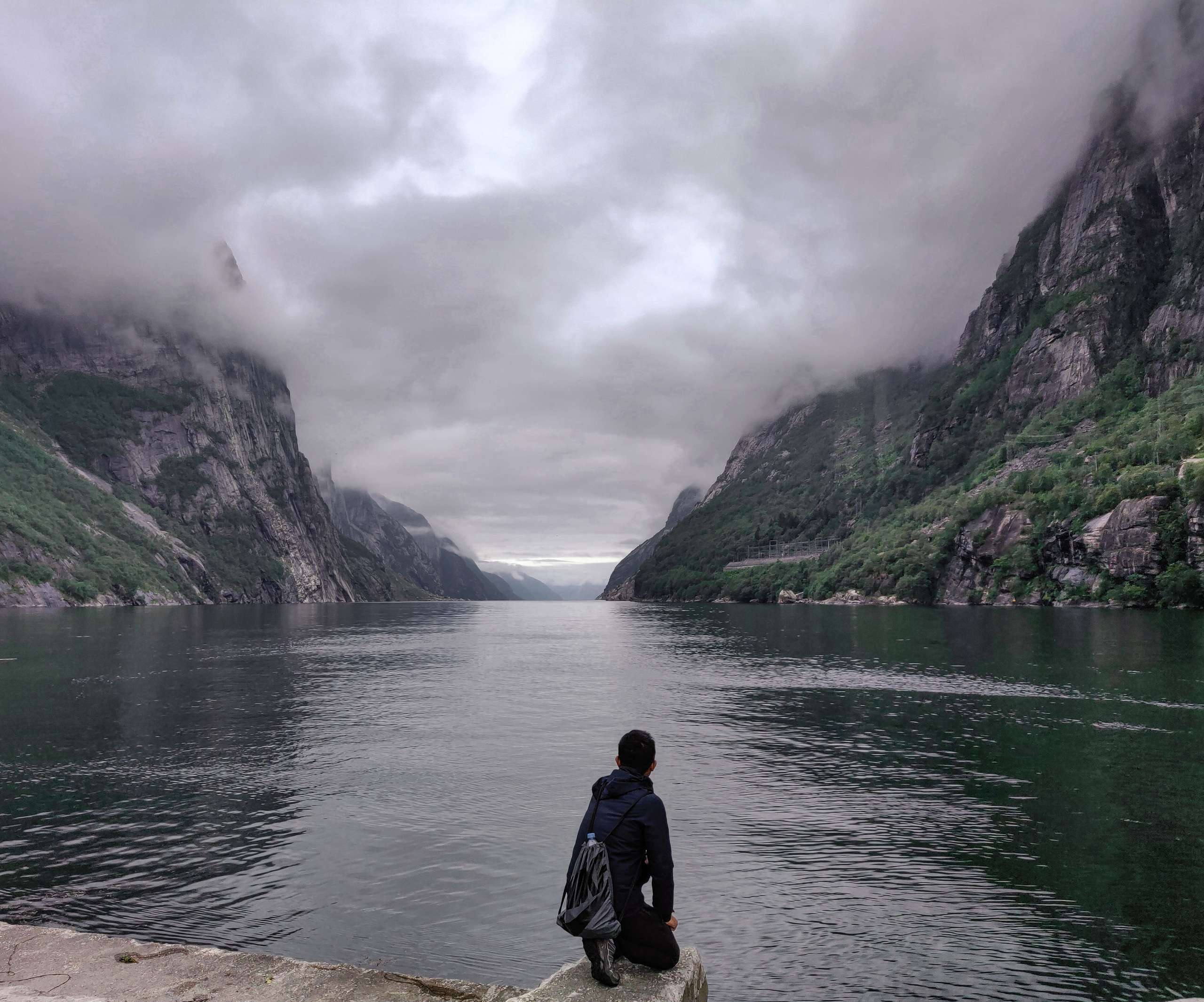
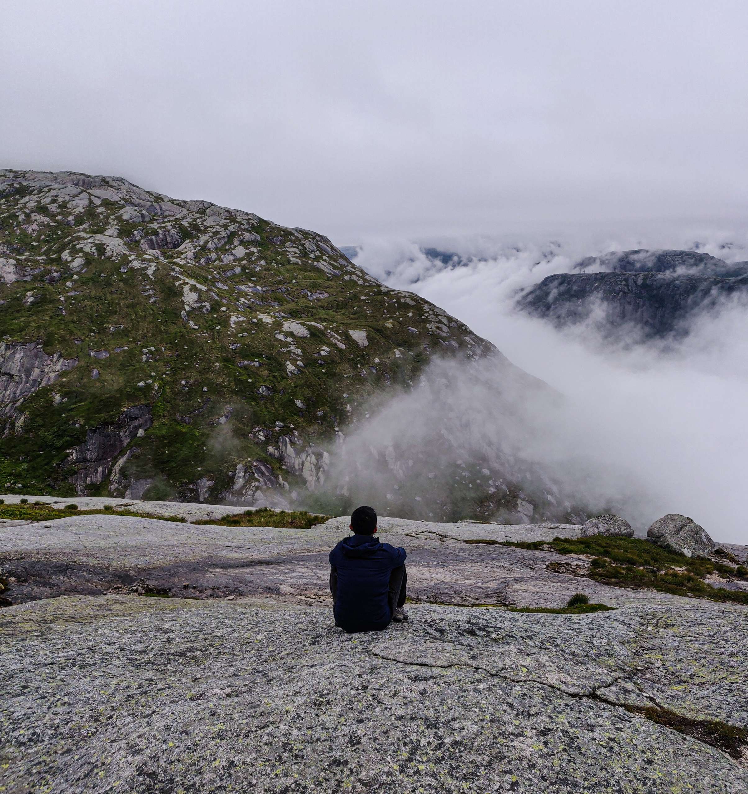
Our guide picked me from the hotel in Stavanger at around 5.30 am in the morning. Our guide was very knowledgable and he was pro at cracking nice jokes. He explained to us about the hike and our itinerary for the day. Kjerag mountain is located in Ryfylke region which is a major tourist spot of Norway. Kjeragbolten and Pulpit rocks are located very close to each other. Pulpit rock is much easier to hike compared to Kjerag but it is very crowded. These days most people prefer to hike Kjerag compared to Pulpit rock. We drove about 1 hour and reached a ferry pier situated at the edge of fjord. The weather was foggy and the visibility was not great. Our guide asked us to pray for better weather so that we can see best views of the Lysefjord from the mountain. During summer season in Norway the weather is always foggy during morning hours and the weather becomes clear during noon time. We boarded the speed-ferry at around 7 am.
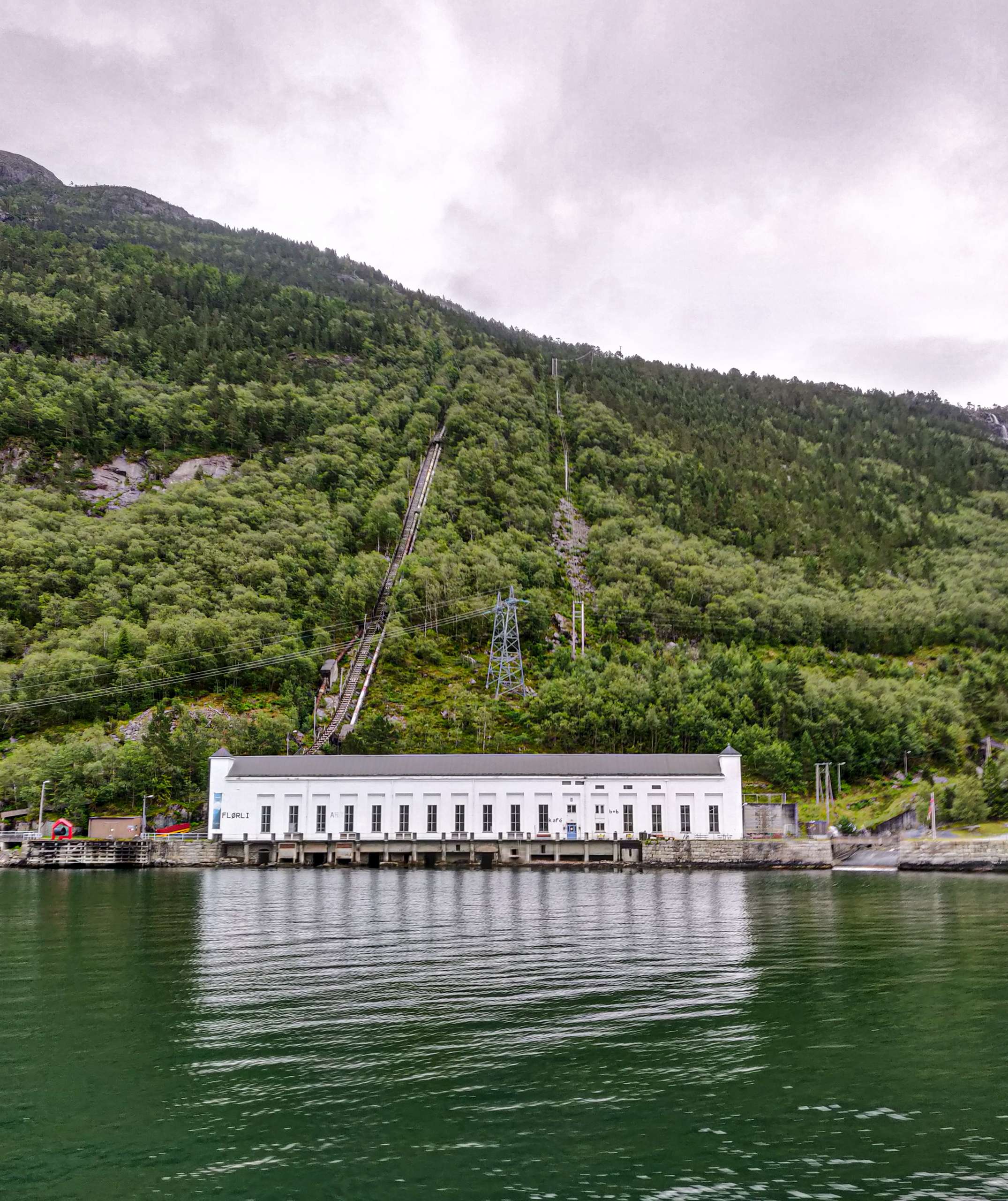
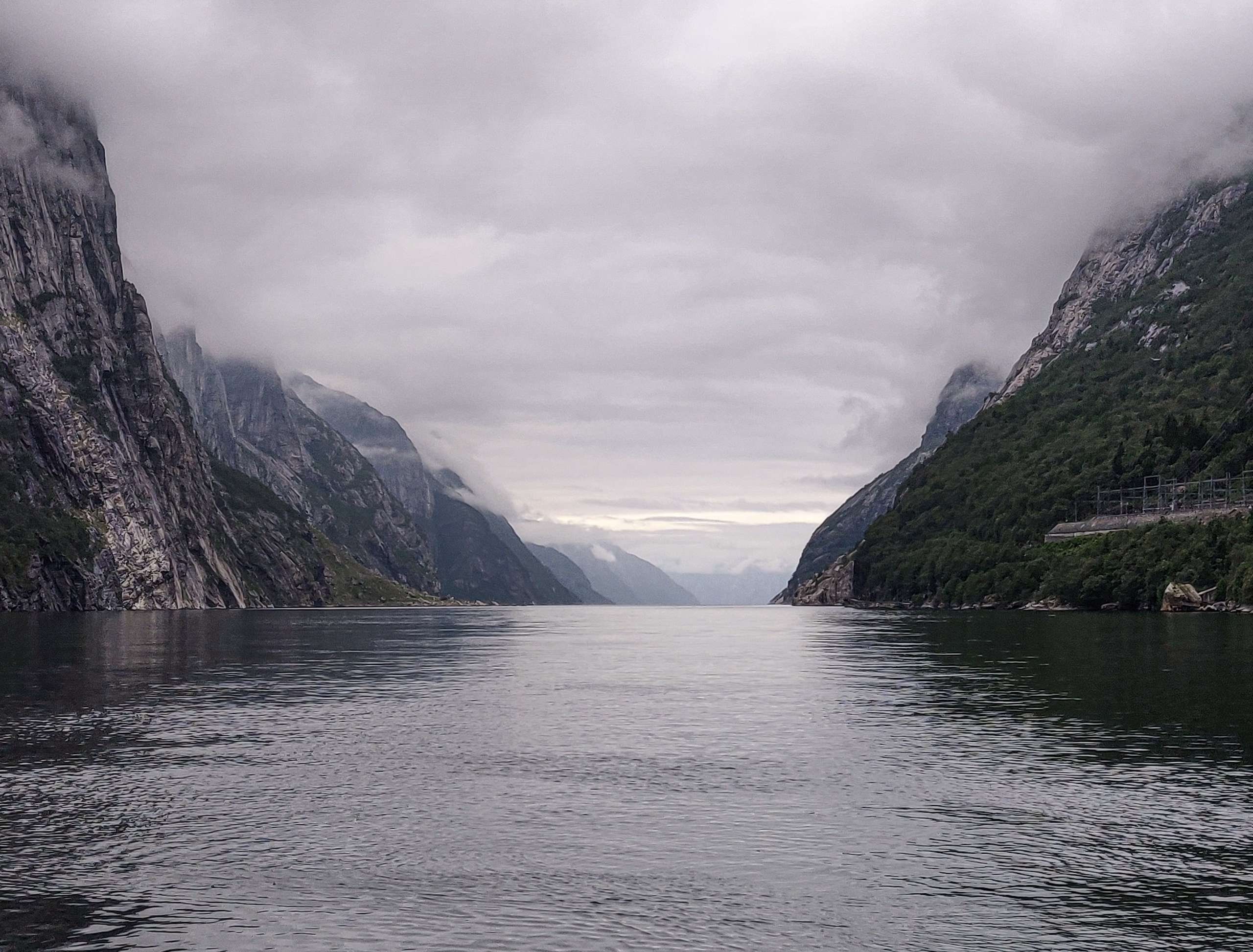
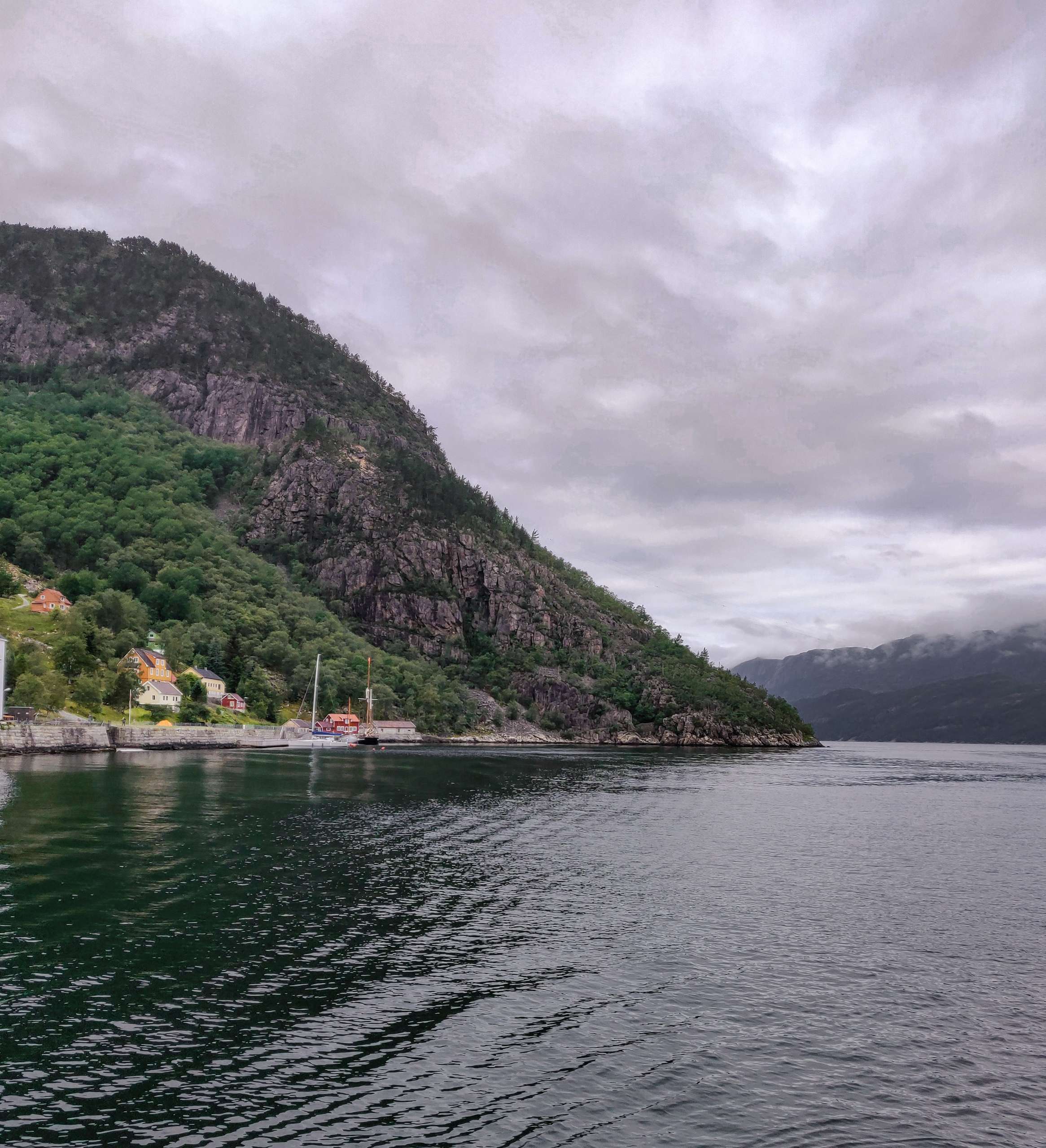
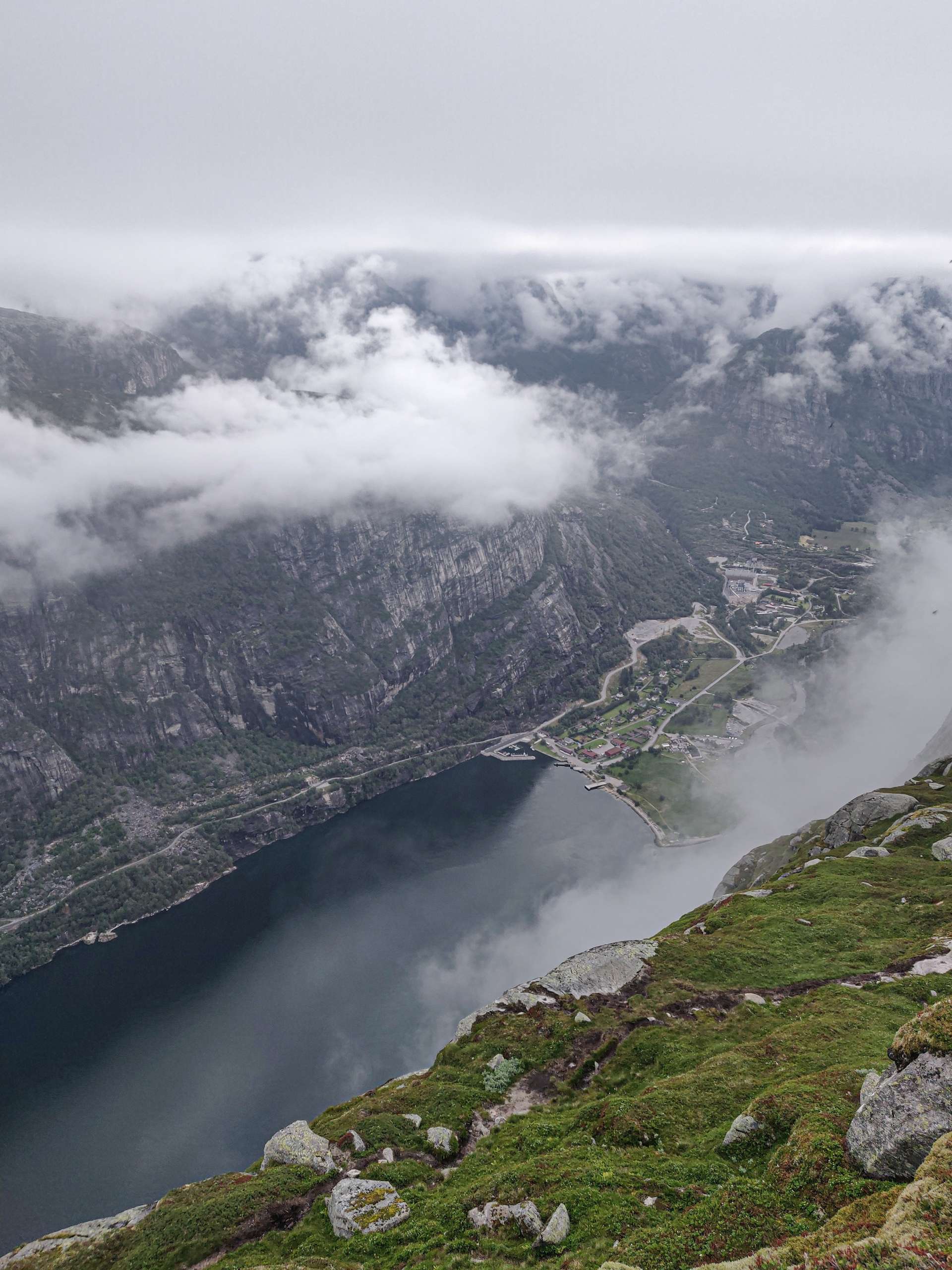
The ferry started cruising along the Lysefjord fjord. The weather was foggy and it was little bit windy. We decided to go to the viewing deck area of the boat. The view of the Lysefjord was amazing from the viewing deck. The mountains around Lysefjord rise about 1000m above the water level. Our first stop was Florli 4444 which is the longest wooden staircase of the world. We saw lot of waterfalls and abandoned farms on our way. Our guide pointed to us the famous Pulpit rock cliff which is rising about 604 m above sea level. We finished our Lysefjord cruise journey at around 8 am. We waited for our guide to bring the car out of the ship. I used this opportunity to take some nice photos of the beautiful fjord. We had to drive for another 30 minutes along the twisty hairpins on the way to hike starting point.
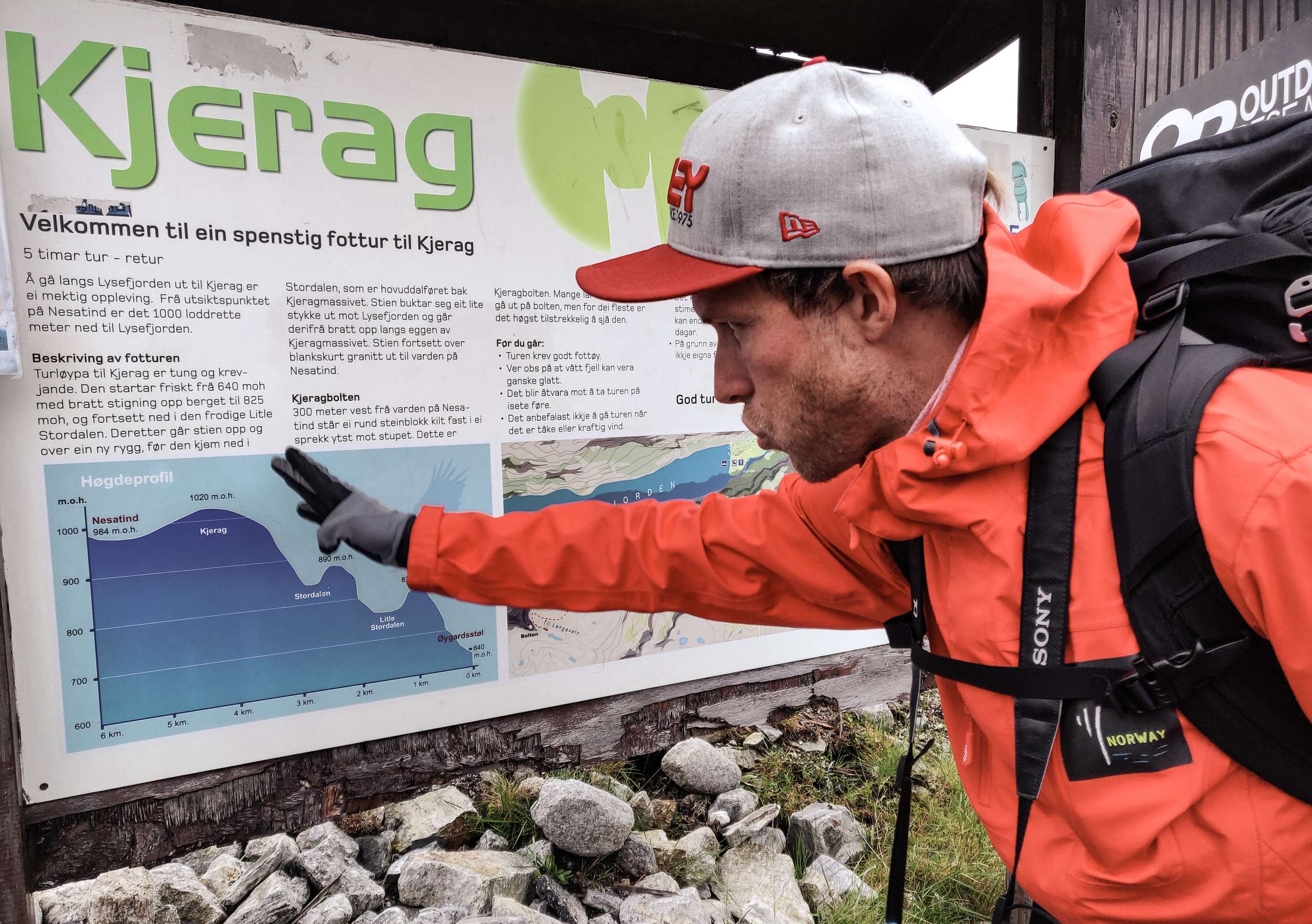
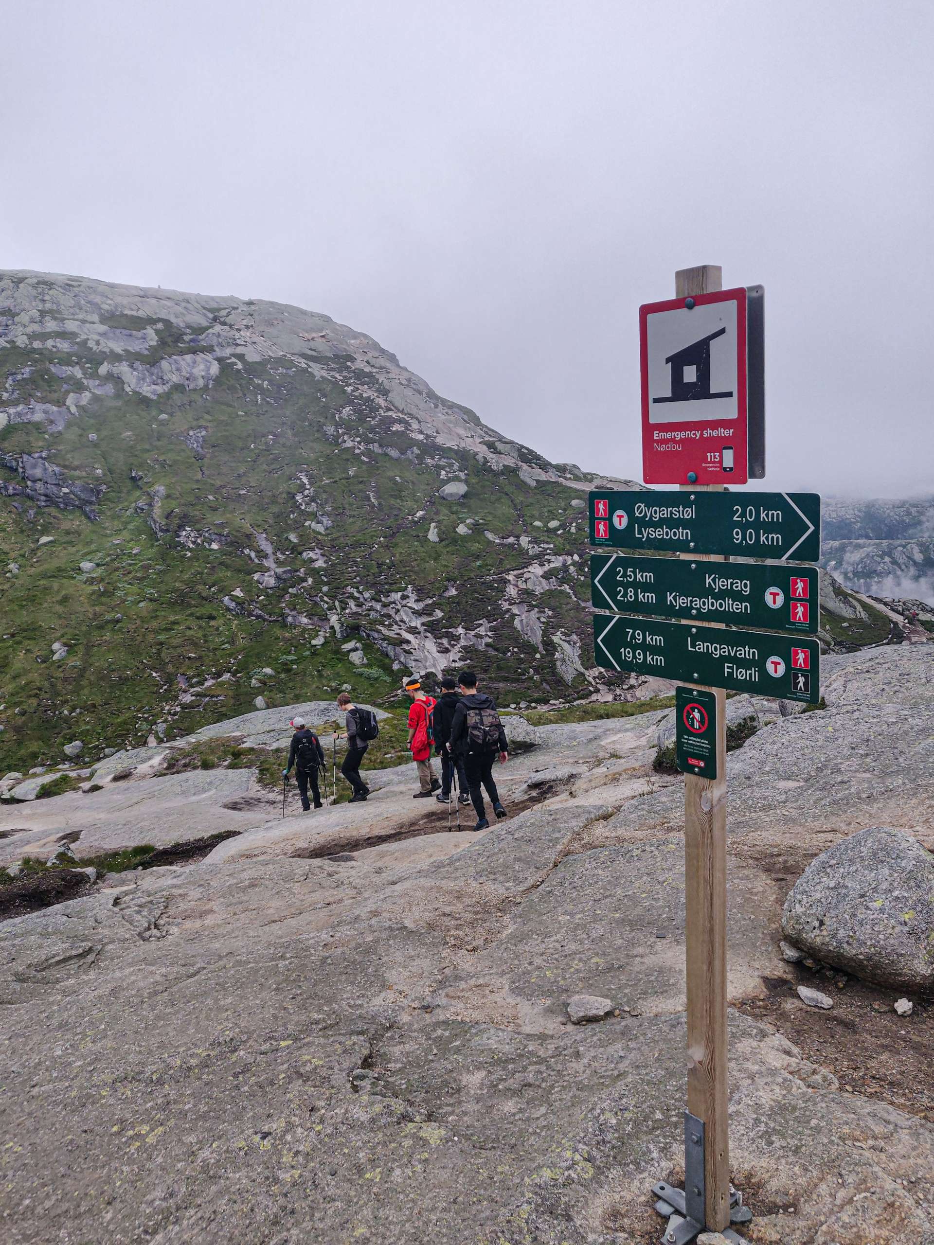
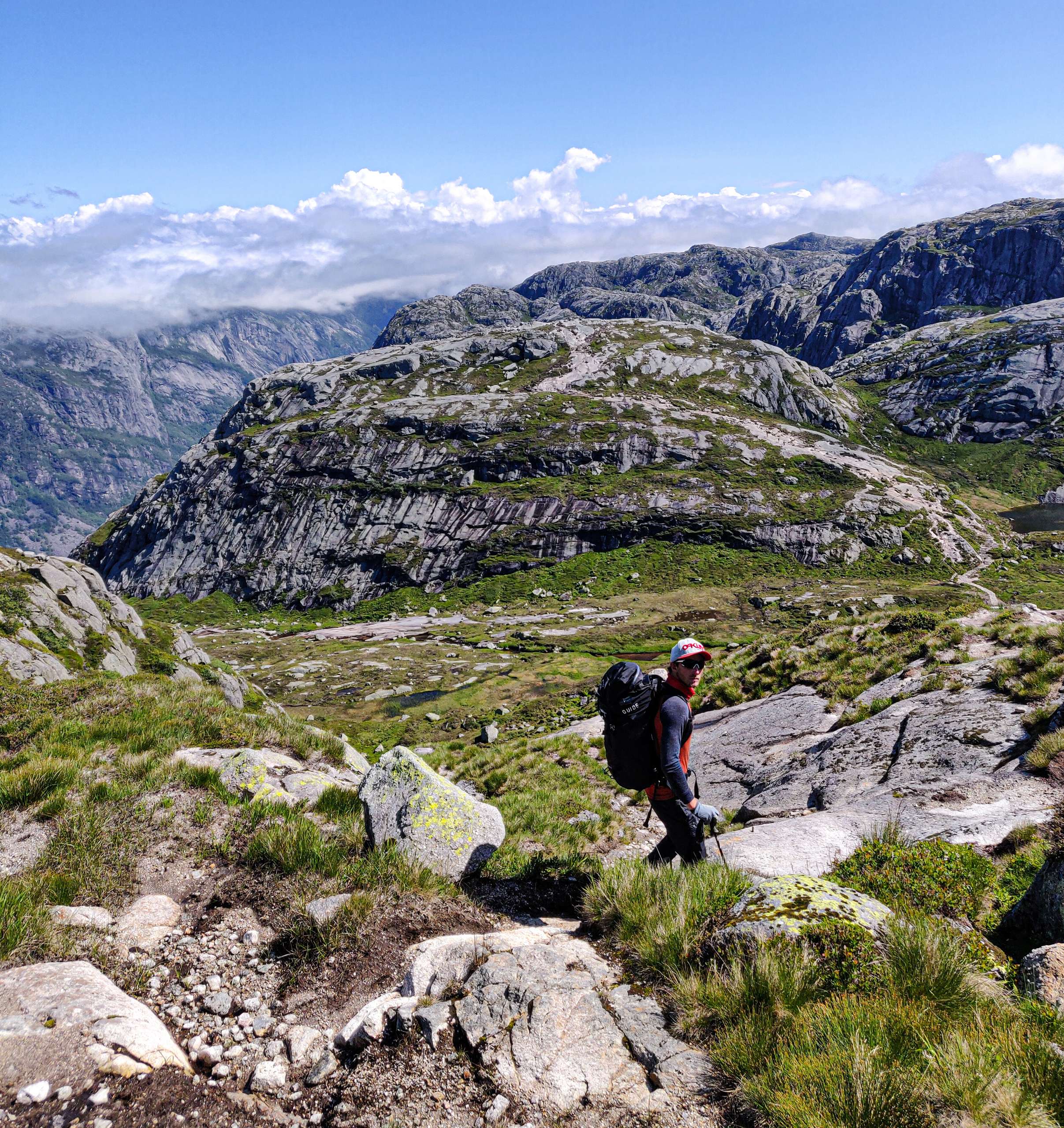
The trail starting point is located about 640m above the sea level. Kjerag is tougher to hike because you gain and loose elevation multiple times during the hike. The hike to Pulpit Rock Is straightforward and you gain height gradually so it is much easier than Kjerag mountain. The hike to Kjeragbolten is round trip 12 km. It takes about 5 to 7 hours to finish the hike. We started our hike at around 8.30 am and our goal was to reach Kjeragbolten by 12 noon. The path to the Kjerag was constructed by Nepali Sherpas. The path to the boulder is well laid out but you can choose different paths on your way up. We had to climb rocky exposed surface for the first 30 minutes of the hike. The rocks were little bit slippery and we had to be little careful during this part of the hike. Our hike was assisted by chains so we didn’t have any trouble climbing this treacherous part of the mountain. Our guide was constantly guiding us individually about where to place our foot so that we can make the climb much safer.
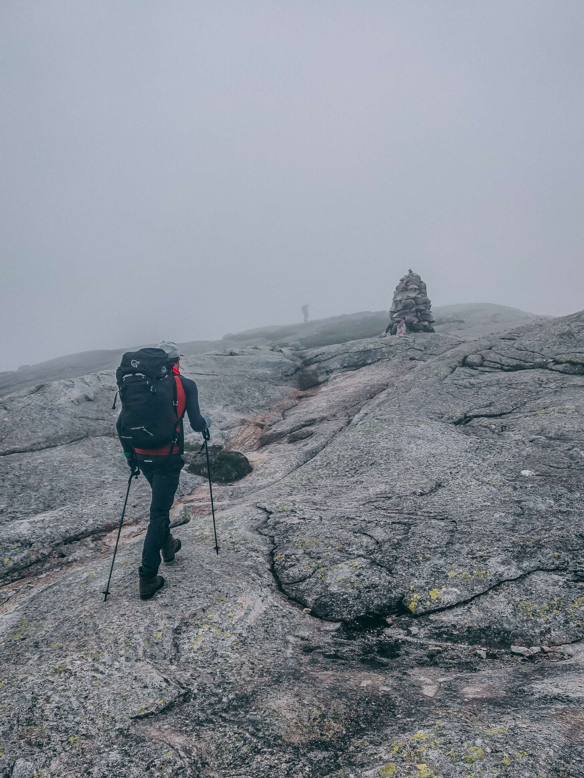
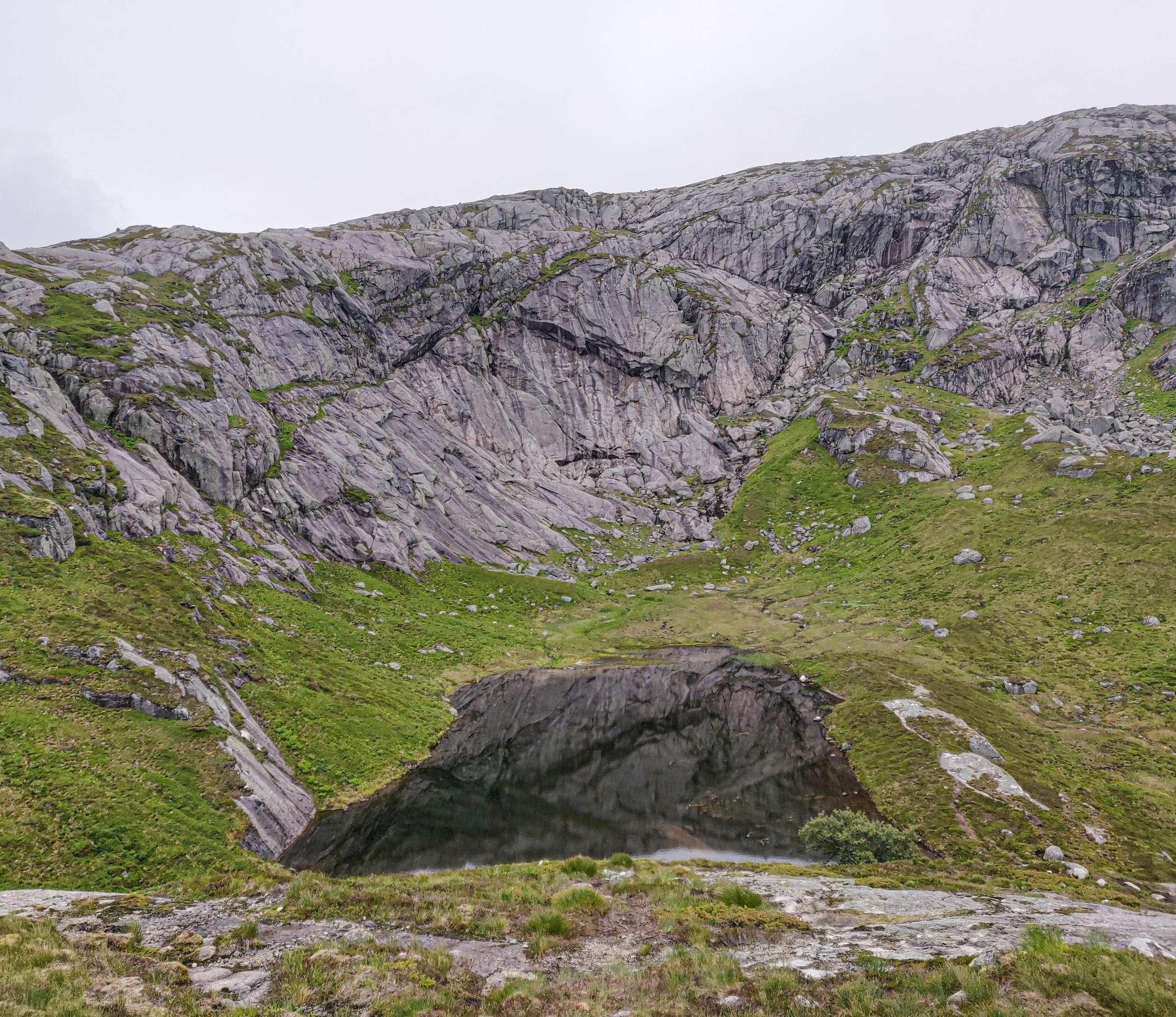
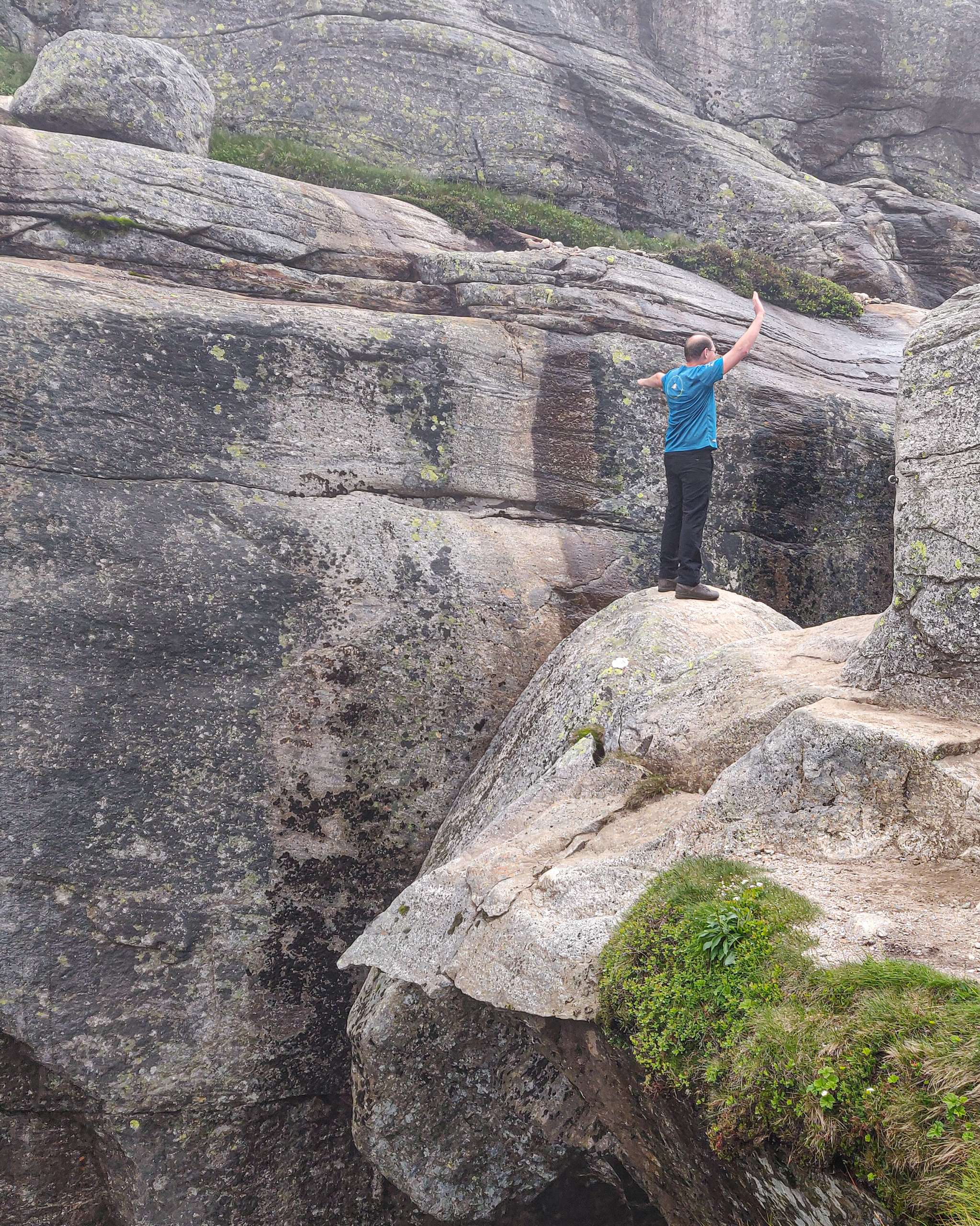
We finally reached the top of the first mountain and we looked down onto the beautiful valley. The lake was formed because of the melting of snow and we also saw lot of sheep around the lake. The weather started getting better and the visibility was much better. We were very positive during the hike and we were hopeful that we will see uninterrupted view of Lysefjord during the hike. The entire hike consists of 3 periods of steep climbing and 2 periods of walking around shallow valleys. We stopped on the top of the first mountain and took some nice pictures of the valley. We filled our bottles with water from the stream. In Norway the water is very clean and you can drink water from the streams. We went down, crossed valley and started climbing the second mountain. The second mountain was much trickier compared to first mountain. The hike was steeper and the path was not properly laid out. It was little bit slippery at some section because of the melting of the snow. Our guide was very helpful and he guided us properly in this tricky section. Outdoor life Norway provides hiking pole to the hikers for free of cost. I took one hiking pole during the hike and it was very useful. After ascending the second section of the mountain we stopped at a rock to take beautiful shot of Lysefjord fjord. The weather was much clearer and the view was amazing from the top.
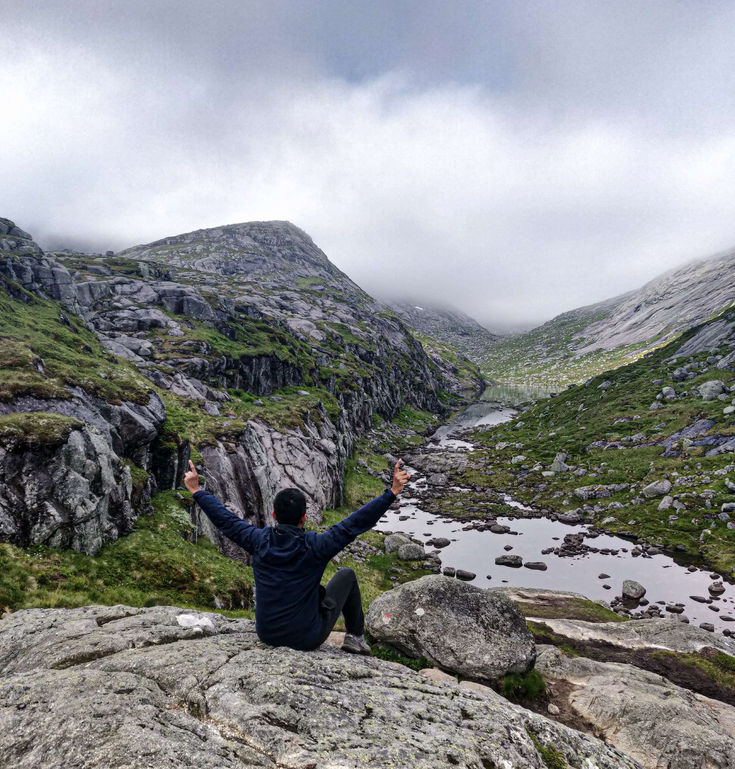
Base jumping is legal in Norway and we saw couple of Base jumpers hiking the Kjerag mountain. They were really fast and after they crossed us they almost vanished in no time. The base jumping site is located further up in the mountain. After reaching the top of the mountain we descended into a narrow valley. The path was properly laid out with stone and we didn’t have any issue following the path. We took 10 minutes rest at this place and it was already 11.15 am. I ate some protein bars and peanuts snacks provided by our guide to gain some energy for the rest of the hike. Our guide told us that the last section of the hike should take us about 1 hour. The climb to the last section was steep and it was supported by chains. After crossing this part, the terrain was relatively flat for the next 2 km.
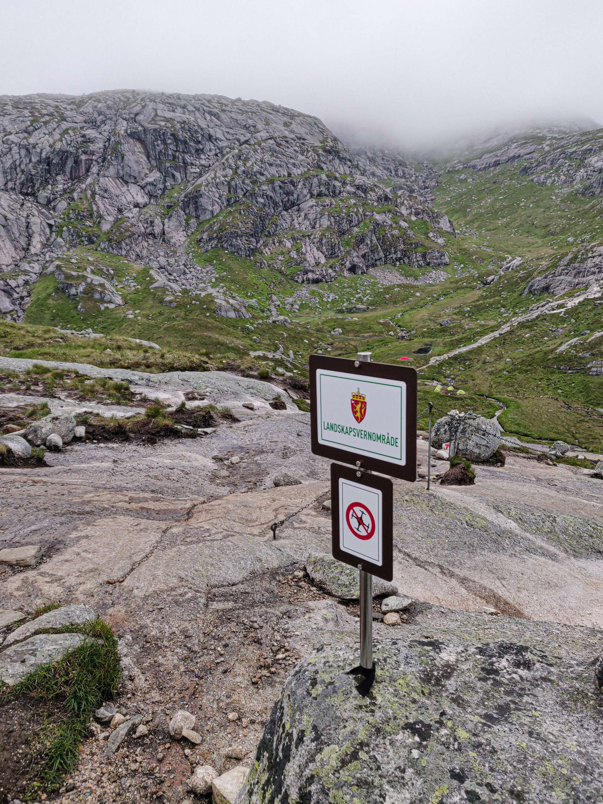
The weather was perfect and we reached Kjeragbolten at around 12.30 pm. The place was not that crowded and there was enough opportunity for everyone to take picture by standing on top of the boulder. You are not allowed to fly drone inside the Norwegian national park because drone sound is not good for deer living around the national park. The last 10 minutes of the hike was very tricky and you have to cross big stones. You might have to clamber up during this section of the hike.
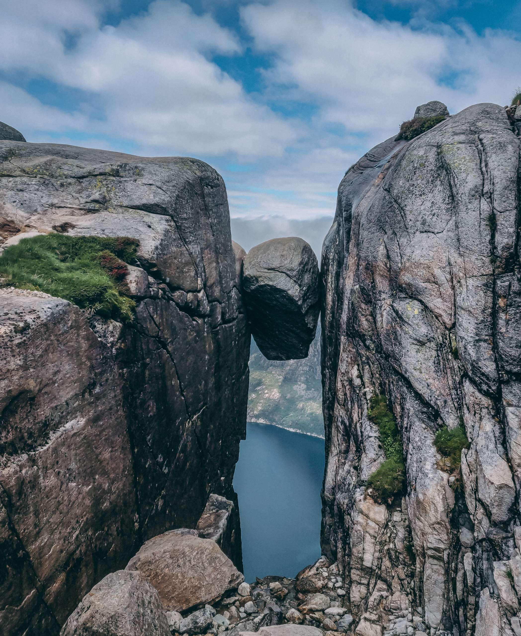
I was completely awestruck by the beauty of the boulder. Researchers say that the boulder was situated on the top of the mountain but because of constant wear and tear the stone finally fell into the crevices. The stone fell perfectly and it got stuck between two flat rocky walls. The rock is situated at the height of 1000 m and fall from the rock will result in death. We were around 6 members in our tour group. I decided before that I will not go to the top of the rock because I saw a Youtube video of someone going to the stone and it was very scary. The path to the stone is very scary and narrow.
One member of our group decided to go first and I helped him to take pictures. All other members of our group didn’t go to the top of rock. One part of me wanted to go to the rock and the other part of didn’t want to go to the top of rock. I was shaking constantly and I couldn’t decide whether to go to the top of the rock or not. My guide told me that no one has ever fallen from the stone. I gathered my strength and asked my guide to help me to reach the stone. He said to me that he will do a demo then I have to do the exact same thing during my turn. He explained to me exactly where to put my feet and I was prepared for my turn. The trickiest part was taking a right turn while you move on to the rock.
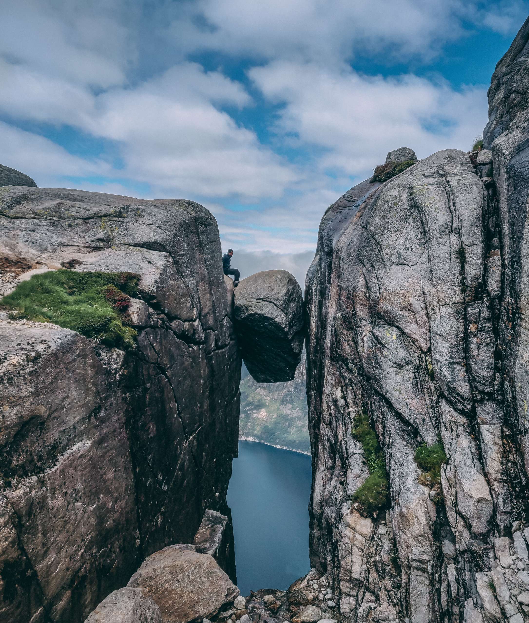
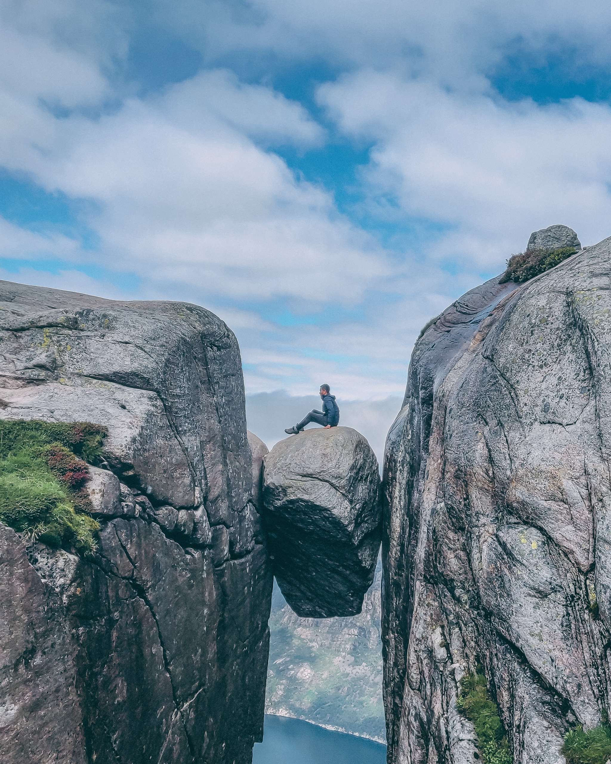
There was hardly any space there and you don’t want to slip here. I managed to take the right turn and sat down. I moved slowly on to the top of the rock and took pictures while sitting down. I was really scared and I didn’t want to stand up on the rock. I told my friend to take pictures of me while was sitting on the rock. After spending 5 minutes at the rock I decided to turn back. There was hardly any space while coming back and you have to take a sudden right and then a left turn. They actually put a small hook in order to hold onto the flat rock while moving around the rock. After this tricky turn it was just straight walk to safety. Your entire weight is supported by the small hook when you take the turn. I strongly feel It was very scary and this is the most scariest thing I have ever done in my life. This is way more dangerous than Trolltunga and Pulpit rock. At Kjeragbolten you don’t have room for error and I am actually shocked that no one fell from the stone while taking pictures. I strongly feel it is just a matter of time before someone falls. The area near Kjerag is full of sharp mountain cliffs. The dark grey colored mountain looks extremely beautiful. We started our return journey at around 1.30 pm.
We crossed the flat mountain valley and reached our first hurdle of the return journey. We had to follow the downward path and it was little tricky. With the help of our guide we slowly descended from the 3rd mountain. We reached the narrow valley and took some rest. We filled our bottles from a stream nearby. we didn’t feel the hike that hard because our guide was constantly entertaining us with nice jokes. We just hand to cover two uphill sections and 2 downhill sections for our return journey.

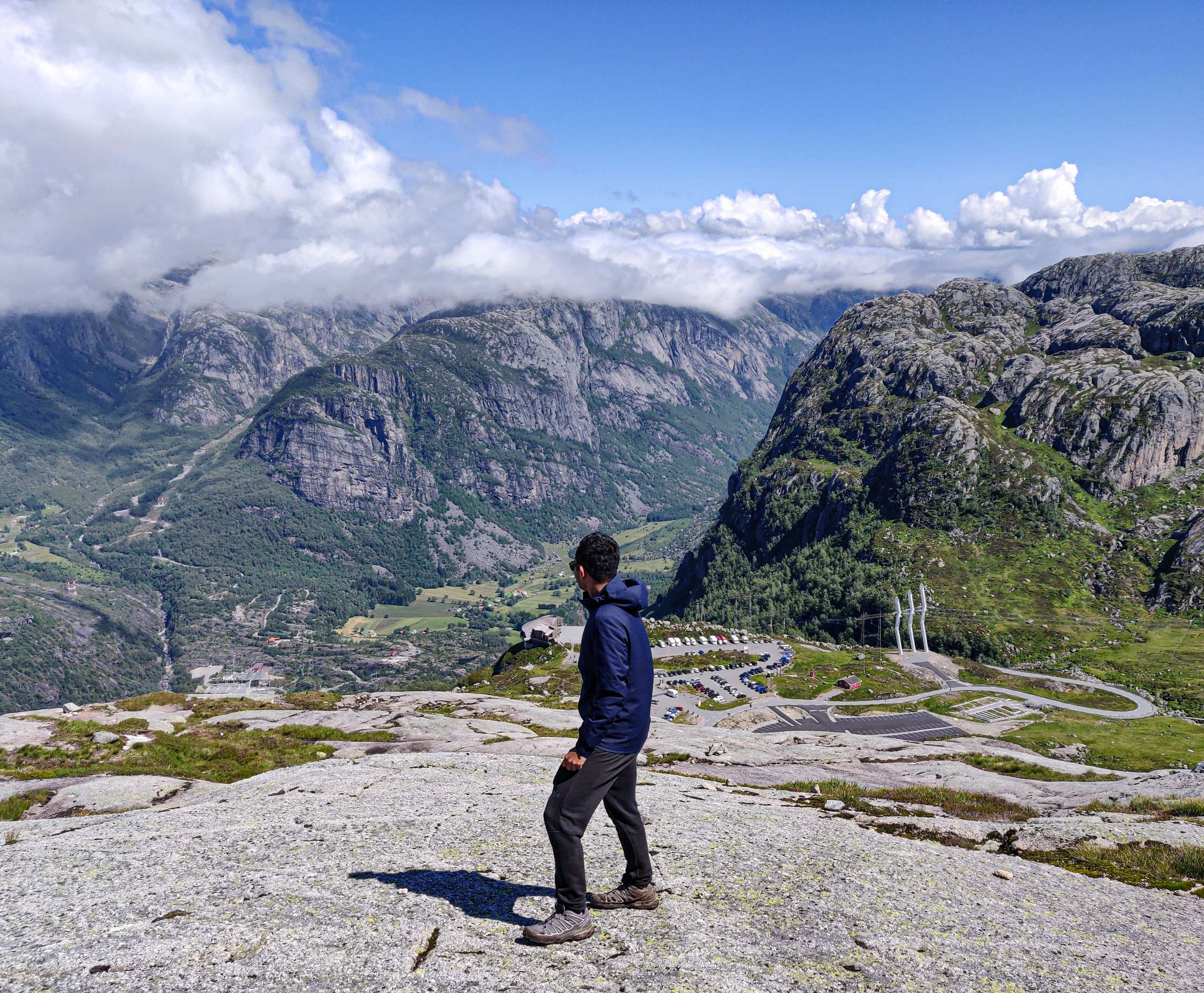
We entered our 1st uphill section and it was much easier because the path was laid out properly. The 2nd downhill section while coming back was the trickiest part of the hike. The main path was very steep and it was slippery. Our guide advised us to take another path on our way down because this path will enhance our grip and we will be easily able to come down in this section. The path was covered with grass and it increased our grip significantly. We slowly came down and reached the main valley area. Our group was very fit and we were all good hikers. Our guide was really impressed by our pace during the hike. We had to just do one uphill section and one downhill section in order to finish the hike. We didn’t have much trouble crossing this section of the hike because the path was properly laid out. Lot of people were carrying camping equipment during our return journey. We didn’t see many hikers doing the hike on our return journey. We reached the parking around at around 4 pm. We took another route on our way back to Stavanger and we skipped ferry ride completely. We passed through some amazing glacier-scoured landscape on our way to Stavanger. I didn’t see much during my return journey because I was really tired after finishing the hike and I slept during the entire return journey.
I reached at my hotel at around 5.30 pm. I really felt better after visiting a destination listed on my bucket list. The entire tour was organized professionally and our guide was very friendly. My next hike was scheduled at 12.30 am the very next day and I had 6 hours to take rest. You can check out my experience of hiking Pulpit rock here.


Leave a Reply